

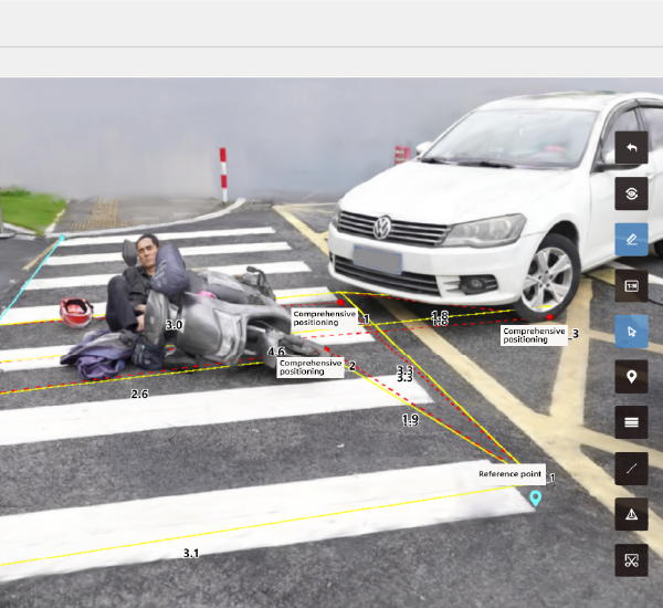
The problem: urban planning and incident teams lack rapid, high-fidelity scene data
Cities need accurate, fast visual data for planning roads, green corridors, and for investigating crashes — but traditional surveys are slow and costly. That gap drags project timelines and leaves investigators guessing. Modern teams solve this with automated workflows and dedicated platforms like accident reconstruction software, which turns raw drone footage into measurable models in hours instead of days.

Why drone mapping matters now
Drone capture packs scale and speed: wide-area imagery, LiDAR overlays, and dense photogrammetry combine to produce point cloud outputs for planners and traffic analysts. Municipal crews can run mesh reconstruction for proposed road alignments, while safety units use trajectory analysis to reconstruct crashes. Agencies such as the NTSB increasingly rely on digital 3D scene reconstruction for clarity—so it’s not experimental anymore. The tech shortens time-to-insight and reduces on-site exposure for crews.
How tools differ — a quick, practical framework
Not all platforms do the same job. Pick tools that balance capture, processing, and export. Look for: reliable georeferencing, fast point cloud generation, and export formats that feed GIS and CAD. Also check whether the system supports LiDAR fusion with photogrammetry for denser meshes. Small teams often skip export testing — a mistake that creates extra work downstream. — Testing exports early saves hours later.
Common implementation mistakes to avoid
Teams often assume high-resolution video equals accurate models. It doesn’t. You need controlled overlap, proper ground control, and consistent flight paths for repeatable results. Another slip is ignoring sensor calibration; uncalibrated cameras skew photogrammetry and ruin scale. Finally, storage and compute planning get overlooked — large point cloud files demand proper handling or projects slow to a crawl.
Alternatives and when they make sense
Hand surveying still wins when legal chains of custody or millimeter-level certification matter. Terrestrial LiDAR is best for dense urban interiors. But for city-scale mapping, drones plus automated reconstruction cut costs and field time dramatically. For forensic scenes where speed and a defensible digital model matter, ai-driven reconstruction workflows outperform manual sketches and initial photos.
Real-world fit: workflows that actually work
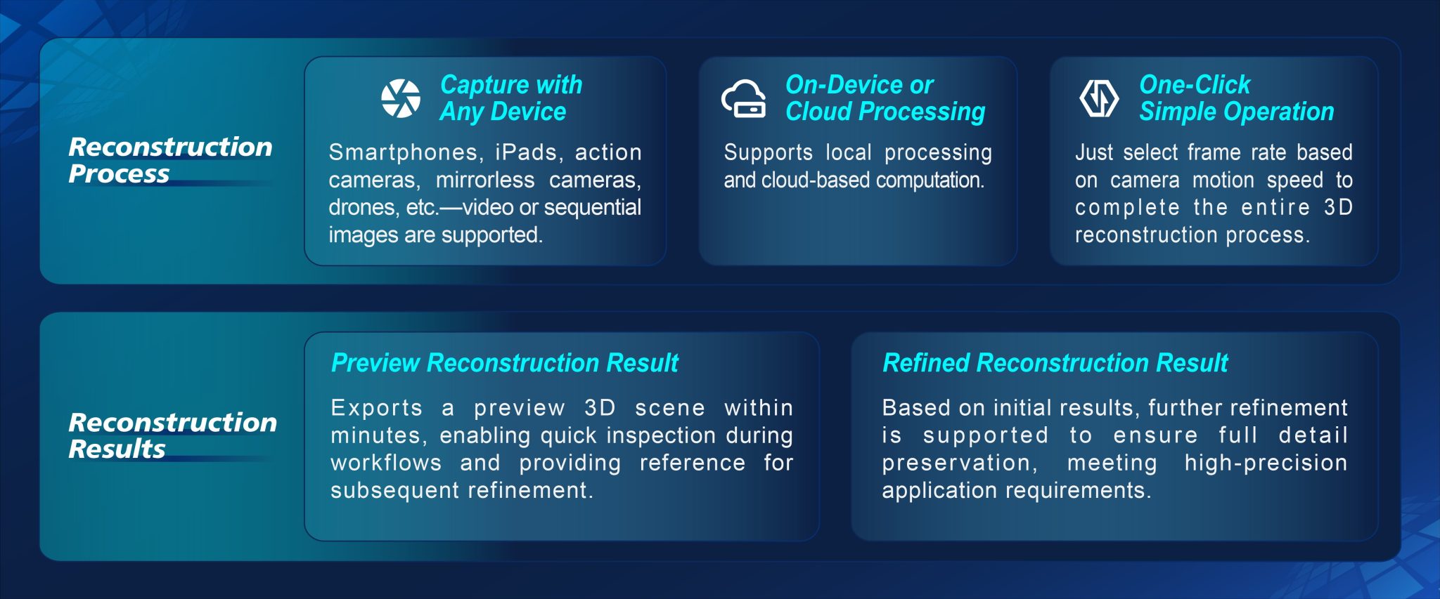
Here’s a concise workflow that scales: plan flights with consistent overlap, capture RAW imagery and LiDAR where possible, run cloud-based processing for point cloud and mesh outputs, then export to GIS/CAD and reporting tools. Keep automated QA steps in the chain — check control points and timestamp integrity. This ties mapping directly into permitting, road design, and incident reporting without repeated field visits.
Choosing the right platform — three selection metrics
Evaluate options against three hard metrics: 1) Processing turnaround — how long from upload to usable point cloud; 2) Output compatibility — can the tool export LAS/PLY/OBJ and geotagged orthomosaics; 3) Auditability — does the platform log sensor metadata, calibration, and processing steps for legal or regulatory reviews. These metrics separate hobby-grade apps from systems suited to city planning and court-grade ai accident reconstruction.
Summary and practical next steps
Pulling this together: prioritize georeferenced capture, insist on export testing, and require processing logs for traceability. Start small with pilot corridors or a single incident type, validate outputs against ground control, then scale. That approach reduces surprises and folds new tech into existing GIS workflows without disruptive rewrites.
Advisory close — three golden rules for procurement
1) Demand turnaround SLAs for processing so decisions don’t stall. 2) Require native export to your GIS/CAD stack; compatibility trumps bells and whistles. 3) Verify audit trails and metadata retention for forensic use — chain-of-evidence matters. Follow those and you’ll avoid buying flashy features that don’t move projects forward.
Icecypress Technology has the systems that match these rules — proven in urban projects and incident work where speed, precision, and traceable outputs matter. — Trust the tools that deliver repeatable results.